Last Updated on November 19, 2026 by Melissa
Pinnacles National Park is the rare California park that’s at its best when everything else is cold, snowed in, or crowded. Its volcanic spires, talus caves, and wild California condors sit about two and a half hours south of San Francisco, and the prime season runs from fall through spring, when summer’s 100-degree heat is long gone.
It’s also one of the most confusing parks to plan. There are two entrances, no road between them, one campground, and a cave system that opens and closes around a bat colony. This guide covers how to choose a side, which hikes to do, where to look for condors, and the practical details (fees, parking, cell service) that trip people up.
Some of the links on this website are affiliate links, which means we may earn a small commission if you make a purchase through them — at no additional cost to you. These commissions help support Part Time Adventuring and allow us to continue creating free travel guides, national park itineraries, hiking resources, and adventure content.
Table of Contents
- Why Visit Pinnacles National Park
- East vs. West Entrance: Which Side to Choose
- Getting to Pinnacles National Park
- Entrance Fees, Hours, and Passes
- Best Time to Visit Pinnacles
- Best Hikes in Pinnacles National Park
- Bear Gulch Cave and Balconies Cave
- Where to See California Condors
- Where to Stay Near Pinnacles
- One-Day and Two-Day Itineraries
- Tips for Visiting Pinnacles
- Pinnacles National Park FAQ
Why Visit Pinnacles National Park
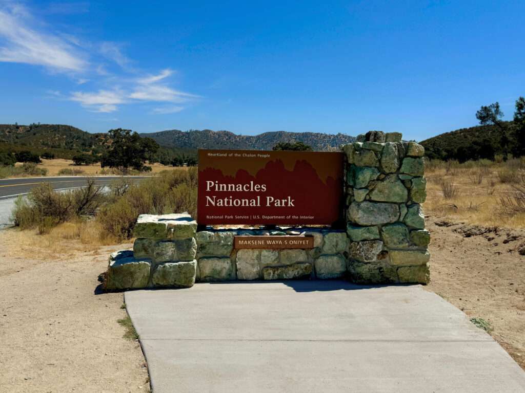
Pinnacles National Park protects the eroded remains of an ancient volcano that formed roughly 23 million years ago, near present-day Los Angeles. The San Andreas Fault has since carried it about 195 miles north. What’s left is a jagged ridge of rhyolite spires, narrow canyons where boulders wedged overhead to form talus caves, and chaparral-covered hills.
Three things set it apart:
- Talus caves. You hike through Bear Gulch Cave and Balconies Cave with a flashlight, squeezing under house-sized boulders. These aren’t the guided, paved caves of Carlsbad or Mammoth.
- California condors. Pinnacles is one of the release sites for the Central California condor flock, which numbered about 116 free-flying birds in the most recent count. Seeing North America’s largest land bird soaring over the High Peaks is a real possibility.
- Low crowds. Pinnacles drew 343,208 visitors in 2025, ranking 149th among National Park Service sites. Compare that to Yosemite, three hours north, with roughly 4 million.
It’s a day trip from the Bay Area or Monterey, and a natural add-on to a Highway 1 or Central Coast road trip.
East vs. West Entrance: Which Side to Choose
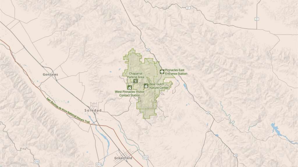
This is the single most important planning decision. No road connects the east and west entrances. Highway 146 enters from both sides but stops short of the park’s center. Driving from one entrance to the other means looping south through King City on Highway 101, which takes about an hour and a half.
You can connect the two sides on foot. The High Peaks and Balconies trails both cross the park.
East Side (Highway 25, Near Hollister)
- Home to the only campground, the camp store, and the Pinnacles Visitor Center
- Access to Bear Gulch Cave, Bear Gulch Reservoir, Condor Gulch, and the Moses Spring trail
- Trails open 24 hours, which matters for sunrise hikes and stargazing. Overnight parking requires a campground reservation.
- Bear Gulch Day Use Area has only 64 parking spaces and fills early on weekends, holidays, and spring days
West Side (Highway 146, Near Soledad)
- Day use only. The gate is open 7:30 a.m. to 8 p.m., with no overnight parking.
- The Chaparral trailhead puts you directly beneath the most dramatic rock formations in the park
- Shortest route to Balconies Cave and the Juniper Canyon climb to the High Peaks
- Highway 146 narrows to a single lane on the final stretch and isn’t recommended for large RVs or buses
Our take: Choose the east side if you’re camping, want the Bear Gulch Cave, or are coming from the Bay Area via Hollister. Choose the west side if you’re coming from Monterey or Highway 101, want the most dramatic scenery for the least driving, or want the shortest hike to Balconies Cave. With two days, do one side each day.
Getting to Pinnacles National Park
Pinnacles sits in the Gabilan Mountains between the Salinas Valley and the San Benito Valley. The nearest airport with regular commercial service is San Jose (SJC), with Monterey (MRY) as a smaller alternative.
East entrance: From Hollister, take Highway 25 south about 30 miles to Highway 146, then turn west into the park. Bear Gulch is 3.5 miles past the campground.
West entrance: From Soledad on Highway 101, take Highway 146 east about 12 to 14 miles to the West Entrance and the Chaparral parking area.
Approximate drive times:
| Starting point | Best entrance | Approximate drive |
|---|---|---|
| San Jose | East | 1.5 hours |
| San Francisco | East | 2.5 hours |
| Monterey | West | 1 hour |
| Los Angeles | West | 4.5 hours |
| Fresno | East | 2.5 hours |
Fill up before you leave Hollister, Soledad, or King City. There’s no gas in the park, and cell service disappears well before the entrance, so download offline maps first.
Entrance Fees, Hours, and Passes
According to the NPS, Pinnacles charges the following entrance fees, each valid for seven days:
- Private vehicle: $30
- Motorcycle: $25
- Per person (on foot or bike): $15. Visitors under 16 are free.
- Pinnacles Annual Pass: $55, valid only at Pinnacles
The park does not accept cash. Bring a card or pay on your phone.
The America the Beautiful pass covers entry. In 2026 the annual pass is $80 for U.S. residents and $250 for nonresidents. Pinnacles isn’t one of the 11 parks with the new $100 nonresident surcharge.
Related: If you’ll visit three or more fee-charging parks this year, the annual pass pays for itself. Here’s our full breakdown: The Ultimate Guide to the America the Beautiful Pass
Hours: The east side is open 24 hours for trail access. The west gate is open 7:30 a.m. to 8 p.m. Visitor center hours vary seasonally, so check the NPS site before you go.
There is no shuttle in service. Plan to drive to the trailheads or hike in from the campground.
Best Time to Visit Pinnacles
The best time to visit Pinnacles National Park is spring (March through May), followed by fall and winter. Here’s how the seasons break down:
- Spring: Peak wildflowers run March through May, with green hills and comfortable hiking temperatures. It’s also the busiest season, so go on a weekday or arrive before 9 a.m. on weekends.
- Fall: Dry, golden hills and warm days. Late October is a good window. The whole Bear Gulch Cave sometimes opens for a week or more depending on bat activity.
- Winter: Cool, quiet, and our pick for avoiding crowds. Most of the park’s roughly 16 inches of annual rain falls from January through March, with February the wettest month. Nights can drop into the low 20s, but daytime hiking is often ideal.
- Summer: July and August regularly top 100°F, and the rock radiates heat. Start hikes at sunrise, carry far more water than you think you need, and finish before noon. Bear Gulch Cave is also fully closed from mid-May to mid-July.
Raptor nesting season (roughly January through July) closes some climbing routes, but it doesn’t affect the main hiking trails.
Best Hikes in Pinnacles National Park
Pinnacles packs a lot into 30-plus miles of trail. Distances and elevation below come from the NPS trail guide.
Moses Spring to Rim Trail Loop (East)
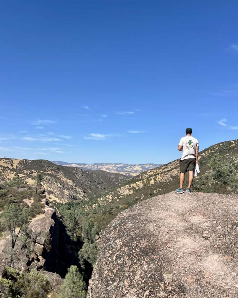
- 2.2 miles round trip, 500 feet, moderate
- The best short hike in the park. It passes through Bear Gulch Cave (when open) to Bear Gulch Reservoir, then returns on the Rim Trail. Bring a flashlight.
Condor Gulch to High Peaks Loop (East)
- 5.3 miles round trip, 1,300 feet, strenuous
- The most direct route from the east side to the High Peaks, with good condor-spotting along the ridge. Hike Condor Gulch up and return via the Bear Gulch side.
High Peaks to Bear Gulch Loop (East)
- 6.7 miles round trip, 1,425 feet, strenuous
- The classic east-side loop. It includes the Steep and Narrow section: carved steps and metal handrails bolted into the rock along an exposed ridge. It’s not technical, but anyone uneasy with heights should know it’s coming.
Balconies Cliffs–Cave Loop (West)
- 2.4 miles round trip, 100 feet, easy to moderate
- The best easy hike on the west side. It runs under the Machete Ridge and Balconies cliffs, through Balconies Cave, and back on the Balconies Cliffs Trail. A flashlight is required, and expect some scrambling.
Juniper Canyon Loop (West)
- 4.3 miles round trip, 1,215 feet, strenuous
- The fastest way to the High Peaks from the west. It’s steep and shaded in the morning, then joins the Steep and Narrow section at the top.
High Peaks to Balconies Cave Loop (West)
- 8.4 miles round trip, 1,540 feet, strenuous
- The full west-side tour, combining the High Peaks and Balconies Cave in one day.
North Chalone Peak (East)
- 9 miles round trip, 2,040 feet, strenuous
- The park’s high point, at 3,304 feet. You’ll find quiet trails and views across both valleys, and on clear days you can see out toward Monterey Bay.
Prewett Point (West)
- 0.9 miles, easy
- A short, accessible walk near the West Contact Station with views of the High Peaks. It’s a good option for families or a sunset stop.
Related: Pinnacles pairs well with California’s other lower-crowd parks. See our Complete Guide to Hiking, Kayaking, and More at Channel Islands.
Bear Gulch Cave and Balconies Cave
Pinnacles’ caves are talus caves: narrow canyons where giant boulders fell and wedged together, creating dark passages underneath. You’ll duck, step through water in wet months, and use your hands. A flashlight or headlamp is required for both caves. Phone flashlights work in a pinch but leave you one-handed.
Bear Gulch Cave (East Side)
Bear Gulch Cave shelters a colony of Townsend’s big-eared bats, and the park manages access around them:
- The lower cave is typically open mid-July through mid-May
- The upper cave is rarely open
- The entire cave closes mid-May to mid-July for pupping season
- The full cave sometimes opens for one to four weeks in March and October, depending on bat activity
As of November 2026, the NPS lists the lower cave as open and the upper cave as closed. Check the cave status page the week of your trip.
Balconies Cave (West Side)
Balconies Cave has no set bat closure, but it can close after flooding, rockfall, or vandalism. It’s darker and more scramble-heavy than Bear Gulch. Reach it from the west on the Balconies Cliffs–Cave Loop, or from the east on the 5.3-mile round-trip Old Pinnacles Trail.
Where to See California Condors
California condors were down to 27 birds in 1987, when every remaining one was taken into captivity. Today Pinnacles co-manages the Central California flock with the Ventana Wildlife Society, and new birds are still released here. Each one carries a numbered wing tag, so you can look up the individual you spot.
According to the NPS, the best condor-viewing strategy is:
- Go to the High Peaks early in the morning or in the early evening. Condors ride thermals off the ridges and roost in the rocks.
- Scan the ridge southeast of the campground. Birds often leave in the morning and return to roost in the evening.
- Use the spotting scopes on the Bench Trail near the Pinnacles Visitor Center.
- Learn the difference from turkey vultures. Condors are much larger (wingspans up to 9.5 feet), fly with flat, steady wings, and have white triangles under the front edge of their wings. Turkey vultures wobble and have silver along the trailing edge.
Sightings aren’t guaranteed. Bring binoculars and budget time to sit and watch.
Where to Stay Near Pinnacles
Pinnacles Campground (East Side)
The only lodging inside the park is Pinnacles Campground, reserved through Recreation.gov. It’s open year-round and includes:
- Standard tent and RV sites, plus about 30 sites with 30-amp electric hookups
- Tent cabins (some with electricity) and group sites
- A camp store with basic food and supplies
- A seasonal swimming pool, normally open April 1 through October 31 with no lifeguard. It’s closed now and reopens in spring 2027.
- No generators at any time
Reserve early for spring weekends.
Hotels in Gateway Towns
There’s no lodging on the west side, so most visitors stay in a nearby town:
- Hollister (east side, about 45 minutes): the most hotels and restaurants on the east approach. Browse Hollister hotels on Booking.com
- Soledad (west side, about 20 minutes): a small town with a few motels, gas, and groceries. Browse Soledad hotels on Booking.com
- King City (south, convenient to both sides): a practical base if you plan to visit both entrances. Browse King City hotels on Booking.com
- Monterey or Salinas: more choice, and Monterey works well if you’re combining Pinnacles with the coast
One-Day and Two-Day Itineraries
One Day (East Side)
- Before 8:30 a.m.: Arrive and park at Bear Gulch
- Morning: Hike the High Peaks to Bear Gulch Loop counterclockwise via Condor Gulch, watching for condors along the ridge
- Midday: Picnic at Bear Gulch, then walk the Moses Spring to Rim Trail Loop through Bear Gulch Cave to the reservoir
- Evening: Scan the ridge near the campground for condors returning to roost
One Day (West Side)
- 7:30 a.m.: Arrive when the gate opens
- Morning: Hike the Juniper Canyon Loop to the High Peaks
- Afternoon: Walk the Balconies Cliffs–Cave Loop
- Sunset: Walk to Prewett Point, then leave before the gate closes at 8 p.m.
Two Days
Camp on the east side and spend day one on the east-side itinerary. On day two, either drive around to the west entrance (about 90 minutes) or hike across the park on the High Peaks to Balconies route for a full traverse.
Related: Heading to the Sierra after Pinnacles? Our Kings Canyon complete visitor guide covers the next stop east.
Tips for Visiting Pinnacles
- Arrive early or go midweek. Bear Gulch’s 64 spaces fill fast, and roadside parking is prohibited.
- Pack a headlamp. Both caves require one.
- Expect no cell service. Download offline maps and the NPS app before you arrive.
- Bring all your food. The campground store is the only food in the park.
- Leave dogs at home for hiking. Pets are allowed only in the campground, picnic areas, parking lots, and paved roads, on a leash no longer than six feet. They aren’t allowed on any trail.
- Watch for poison oak. It grows along many trails, especially in shaded canyons.
- Carry more water in warm months. There’s little shade on the High Peaks.
- Bring a card. There’s no cash payment at the entrance.
For more ways to stretch a park budget, see our guide to national parks on a budget.
Pinnacles National Park FAQ
Can you drive through Pinnacles National Park from east to west?
No. There’s no road connecting the east and west entrances. Driving between them takes about 90 minutes via King City, but you can hike between the two sides on the High Peaks or Balconies trails.
Which entrance is better at Pinnacles, east or west?
The east entrance has the campground, Bear Gulch Cave, and 24-hour trail access. The west entrance has the most dramatic rock formations near the parking lot and the quickest route to Balconies Cave. Choose by where you’re coming from and which cave you want to see.
How many days do you need at Pinnacles National Park?
One day is enough to hike the High Peaks and see one cave. Two days let you cover both the east and west sides without rushing.
Are the caves at Pinnacles open?
Bear Gulch Cave closes completely from mid-May to mid-July to protect a bat colony, and its upper section is rarely open. Balconies Cave is usually open unless flooding or rockfall closes it. Check the NPS cave status page before your trip.
Where can I see condors in Pinnacles National Park?
The High Peaks in early morning or early evening is the best bet. You can also scan the ridge southeast of the campground, or use the spotting scopes near the Pinnacles Visitor Center.
What is the best month to visit Pinnacles National Park?
March and April are the best months, with wildflowers and mild temperatures. Late October through February is quieter, while July and August often top 100°F.