Last Updated on June 19, 2026 by Melissa
Big Bend National Park sits at the end of a very long road in the remote desert of southwest Texas — and that’s exactly the point. More than 800,000 acres of Chihuahuan Desert, river canyons, and sky-island mountains, all of it tucked into a bend in the Rio Grande with virtually no services for miles in any direction. We’ve been to a lot of national parks, and Big Bend is the most remote-feeling one in the lower 48.
This guide covers everything you need to plan your trip: where to stay, the best hikes, things to do, a three-day itinerary built on our own experience, and the practical details most guides skip.
Some of the links on this website are affiliate links, which means we may earn a small commission if you make a purchase through them — at no additional cost to you. These commissions help support Part Time Adventuring and allow us to continue creating free travel guides, national park itineraries, hiking resources, and adventure content.
Table of Contents
Best Time to Visit Big Bend
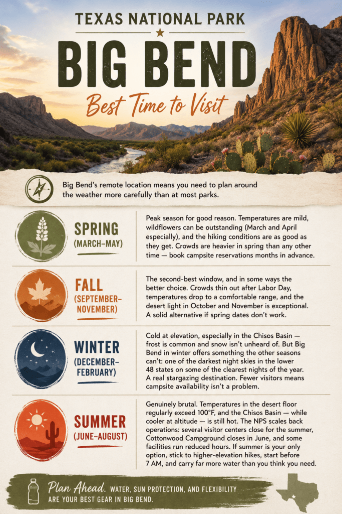
Big Bend’s remote location means you need to plan around the weather more carefully than at most parks.
Spring (March–May)
Peak season for good reason. Temperatures are mild, wildflowers can be outstanding (March and April especially), and the hiking conditions are as good as they get. Crowds are heavier in spring than any other time — book campsite reservations months in advance.
Fall (September–November)
The second-best window, and in some ways the better choice. Crowds thin out after Labor Day, temperatures drop to a comfortable range, and the desert light in October and November is exceptional. A solid alternative if spring dates don’t work.
Winter (December–February)
Cold at elevation, especially in the Chisos Basin — frost is common and snow isn’t unheard of. But Big Bend in winter offers something the other seasons can’t: one of the darkest night skies in the lower 48 states on some of the clearest nights of the year. A real stargazing destination. Fewer visitors means campsite availability isn’t a problem.
Summer (June–August)
Genuinely brutal. Temperatures in the desert floor regularly exceed 100°F, and the Chisos Basin — while cooler at altitude — is still hot. The NPS scales back operations: several visitor centers close for the summer, Cottonwood Campground closes in June, and some facilities run reduced hours. If summer is your only option, stick to higher-elevation hikes, start before 7 AM, and carry far more water than you think you need.
How to Get to Big Bend National Park
Big Bend’s location is the defining feature of any trip here — there’s no easy way in, and that’s part of what keeps it from being overly crowded. You’ll need a car no matter how you get to Texas.
Nearest airports:
- Midland/Odessa (MAF) — 3 hours
- El Paso (ELP) — 4 hours
- San Antonio (SAT) — 5.5 hours
- Dallas/Fort Worth (DFW) — 7.5–8 hours
Driving times from major Texas cities:
- Austin: approximately 6.5 hours
- Houston: approximately 8.5 hours
- Dallas: approximately 8 hours
The two main entry points are Persimmon Gap in the north (coming from Marathon on US-385) and Maverick in the west (coming from Terlingua). If you’re based in Terlingua or Study Butte, you’ll use Maverick. If you’re looping in from Alpine or Marathon, Persimmon Gap is your route.
Cell service inside the park is extremely limited. Download offline maps before you arrive — Google Maps offline, Gaia GPS, or the NPS app all work. Don’t count on navigation or communication once you’re past the entrance station.
Road conditions matter here more than most parks. Many backcountry roads require true 4WD with high clearance. Do not attempt Old Maverick Road, Old Ore Road, or Black Gap Road in a standard passenger car, minivan, or crossover. Road conditions also change quickly after rain; always check the NPS alerts page before heading out.
Entrance Fees
Big Bend charges $30 per vehicle (valid 7 days), $25 for motorcycles, and $15 per person on foot or bicycle. The America the Beautiful Annual Pass ($80) covers entry here and at all other federal recreation sites — a good deal if you’re visiting more than one or two parks. One thing worth knowing: Big Bend is entirely cashless, so have a credit or debit card ready at the gate.
Where to Stay at Big Bend
Inside the Park
Chisos Mountains Lodge is the only lodge inside the park. Rooms are simple but the mountain views from the basin are hard to beat, and being inside the park means you’re steps from the best trailheads. Book far in advance — this fills up, especially in spring.
Developed campgrounds all require reservations via Recreation.gov at $16 per night:
- Chisos Basin Campground — highest elevation, coolest temps, best base for Chisos hikes. Sites go fast.
- Rio Grande Village Campground — lower desert, hotter, but excellent access to the river area and Boquillas. Has RV hookups — the only in-park option with hookups.
- Cottonwood Campground — near Castolon, good for accessing Santa Elena Canyon. Closes in summer (typically June through October).
About two-thirds of sites at Rio Grande Village and Chisos Basin are reservable up to 6 months ahead; the remaining third open 14 days out.
Terlingua and Study Butte
For those not camping inside the park, Terlingua is the best base. It’s a quirky ghost town turned small community with a handful of restaurants, a few bars worth sitting at, and more lodging than you’d expect. We stayed in Terlingua during our trip — easy access in through the Maverick entrance and enough character to make the evening worth sticking around for. Search hotels and rentals in Terlingua.
Study Butte sits right next to Terlingua and has several additional options including RV parks. Search hotels in Study Butte.
For RVers: Rio Grande Village is the only campground inside the park with hookups. Outside the park, Terlingua and Study Butte both have RV parks. The paved park roads are manageable with a standard motorhome or tow vehicle — just know that the road into Chisos Basin has tight turns and is not recommended for rigs over 24 feet.
Upscale Options
Lajitas Golf Resort is about 17 miles from the park and is the most polished lodging option in the area — full resort amenities and a golf course in the middle of the Chihuahuan Desert. Check availability at Lajitas Golf Resort.
Best Hikes in Big Bend National Park
Big Bend has trails across a wide range of difficulty and distance. Here are the ones worth planning your trip around, including three we’ve done ourselves.

Emory Peak — Strenuous
The highest point in Big Bend at 7,825 feet. The trail is about 10 miles round-trip from the Chisos Basin Visitor Center with roughly 2,450 feet of elevation gain — most of it on the Pinnacles Trail, which doesn’t let up. The final push to the summit involves a short rock scramble that looks intimidating but is straightforward for most hikers. Views from the top cover the entire park in every direction, into Mexico, and across miles of Chihuahuan Desert.
We did Emory Peak during our trip and it’s the hike that sticks with us most from Big Bend. Start by 6 AM — by late morning the exposed sections get punishing, and there’s no shade for long stretches. Carry at least 3 liters of water per person.
Lost Mine Trail — Moderate
4.8 miles round-trip, about 1,100 feet of gain. This is the best bang-for-effort hike in the park — manageable enough for most visitors, but the views at the top are genuinely spectacular. The trail climbs through oak and pine before opening up onto a ridgeline with sweeping views of the Chisos Basin and Casa Grande peak. We did this one on our second day, and it holds up perfectly as a slightly lighter hike after Emory Peak the day before. Parking at the trailhead fills up fast — get there early.
Santa Elena Canyon Trail — Easy
1.7 miles round-trip. One of the most striking short hikes anywhere in the national park system. You walk along the Rio Grande into the mouth of a canyon with 1,500-foot limestone walls rising straight up on both sides — Mexico on one side, Texas on the other. The trail requires crossing the bed of Terlingua Creek near the trailhead, which can be dry sand or flowing water depending on recent rain. Check conditions with a ranger before heading out. We did this trail and the scale of those walls doesn’t fully register from photos until you’re standing in it.
The Window Trail — Moderate
5.6 miles round-trip, descending into a canyon to a pour-off where the drainage funnels through a gap in the rock. A good sunset hike. Just remember the return is all uphill.
The South Rim Loop — Strenuous
12–14 miles, full loop. The crown jewel for serious hikers — a high-altitude loop with views south into Mexico that stretch for a hundred miles. Often done as an overnight backpack. If you’re in good shape and have the time, this is the best long hike in the park.
Boquillas Canyon Trail — Easy
1.4 miles round-trip along the Rio Grande with canyon walls building as you walk in. Good for families or as an add-on when visiting the Boquillas area.
Related: The 20 Best Easy National Park Hikes You Can Actually Do
Things to Do Beyond Hiking
Santa Elena Canyon
Worth visiting even if you don’t hike the trail. The drive out along Ross Maxwell Scenic Drive is one of the better scenic routes in the park, and the view from the canyon entrance gives you a sense of the scale before you even start walking.
Boquillas Crossing
An official U.S./Mexico port of entry inside the park. You cross the Rio Grande into the small Mexican village of Boquillas del Carmen for lunch, drinks, and local artisan goods. Passport required — this is a real border crossing. The port is open Friday through Monday, 9 AM to 4 PM. Worth doing for the novelty of it and the tacos.
Big Bend Hot Springs
A short 0.5-mile walk from the trailhead to natural thermal pools along the Rio Grande. After a long day of hiking, this is exactly what your legs want. Water temperature stays around 105°F year-round.
Stargazing
Big Bend is one of the least light-polluted parks in the lower 48. The Milky Way is visible to the naked eye on clear nights, and the park holds regular ranger-led stargazing programs. Drive away from the Chisos Basin Lodge area to a pullout for the best views.
Rio Grande Float Trips
Big Bend River Tours out of Terlingua offers guided rafting and canoeing through Santa Elena Canyon, Boquillas Canyon, and other sections. A guided float through Santa Elena gives you a completely different perspective on the canyon than the trail does.
Fossil Discovery Exhibit
An outdoor exhibit along the main road near Persimmon Gap with life-size fossil replicas of prehistoric creatures that lived here — including Quetzalcoatlus, a pterosaur with a 35-foot wingspan that ranks among the largest flying animals ever discovered. Free with park admission, and a good stop when driving in or out.
3-Day Big Bend Itinerary
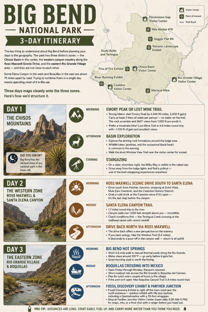
The key thing to understand about Big Bend before planning your days is the geography. The park has three distinct zones — the Chisos Basin in the center, the western canyon country along the Ross Maxwell Scenic Drive, and the eastern Rio Grande Village area — and they are not close to each other. Santa Elena Canyon in the west and Boquillas in the east are about 75 miles apart by road. Trying to combine them in a single day means spending most of it in the car.
Three days maps cleanly onto the three zones. Here’s how we’d structure it.
Day 1: The Chisos Mountains
The Chisos Mountains anchor the center of the park and should anchor your first day. Start early — the mountain hikes are demanding and you want to be off the exposed trails before afternoon.
Morning: Emory Peak or Lost Mine Trail
If you’re a strong hiker, start Emory Peak by 6 AM. At 10 miles and 2,450 feet of gain, it will fill most of your morning. Carry at least 3 liters of water per person — there’s no water on the trail. The short rock scramble at the top is worth it; the 360-degree view from 7,825 feet is the best in the park. We did this hike on our trip and it’s the one that still stands out.
If Emory Peak isn’t the right fit, Lost Mine Trail is the better moderate option — 4.8 miles round-trip, about 1,100 feet of gain, with excellent views the whole way up. We did this one on our second Chisos day and it’s a great hike in its own right.
Afternoon: Basin exploration
After your hike, stay in the basin. The rock formations around the lodge area are striking, and wildlife — deer, javelinas, and the occasional black bear — is common near the basin in the evening hours. The short Window View Trail near the visitor center is worth a walk for sunset.
Evening: Stargazing
Big Bend has the darkest skies of any national park in the lower 48. On a clear moonless night, the Milky Way is visible to the naked eye. Drive away from the lodge lights and find a pullout — it’s one of the better stargazing experiences you’ll have anywhere.
Day 2: The Western Zone — Ross Maxwell and Santa Elena Canyon
Day 2 heads west. The Ross Maxwell Scenic Drive runs about 30 miles from Panther Junction down to Santa Elena Canyon, with plenty of stops along the way. Give yourself the full day.
Morning: Ross Maxwell Scenic Drive south to Santa Elena
Head out early and drive south on Ross Maxwell, stopping at the overlooks along the way — Sotol Vista, Mule Ears Overlook, and the Castolon Historic District are all worth slowing down for. Grab a cold drink at the Castolon store if it’s open — it’s the last stop before the canyon.
Midday: Santa Elena Canyon Trail
The trail is only 1.7 miles round-trip but the canyon walls rising 1,500 feet straight above you are something that doesn’t translate in photos. Spend time at the back of the trail where the walls close in on both sides. Check conditions first — the Terlingua Creek crossing at the trailhead varies with recent rainfall and can be impassable after heavy rain.
Afternoon: Drive back north via Ross Maxwell
The drive back gives you a different perspective on everything you saw coming in. If you have energy left, the Window Trail (5.6 miles, descends to a pour-off in the canyon wall) makes a good late afternoon hike — just remember the return is all uphill.
Day 3: The Eastern Zone — Rio Grande Village and Boquillas
Day 3 goes east toward the river country. This zone feels different from the rest of the park — lower, hotter, and closer to the Rio Grande.
Morning: Big Bend Hot Springs
Start with the hot springs before the day heats up. It’s a short 0.5-mile walk from the trailhead to natural thermal pools along the Rio Grande that stay around 105°F. Early morning here is quiet and worth the timing.
Midday: Boquillas Crossing into Mexico
If your third day falls on a Friday through Monday, plan to cross into Boquillas del Carmen for lunch. Passport required — the crossing is a short rowboat ride across the Rio Grande, and the village on the other side is worth a couple of hours. It’s a genuinely unusual experience for a national park visit.
If the port isn’t open on your day, use the time for the Boquillas Canyon Trail instead — an easy 1.4-mile walk along the Rio Grande as the canyon walls build around you.
Afternoon: Fossil Discovery Exhibit and Panther Junction on your way out
The Fossil Discovery Exhibit is right off the main road near the north entrance — a good final stop before leaving the park. The outdoor exhibit includes life-size replicas of the prehistoric creatures that once lived here, including a Quetzalcoatlus with a 35-foot wingspan. Panther Junction Visitor Center (open daily 8:30 AM–5 PM) is just down the road if you need maps or want to talk to a ranger before the drive home.
Tips Before You Go
Bring more water than you think you need. This sounds like standard advice until you’re on the Pinnacles Trail in April with the sun coming over the ridge and you’ve already gone through your first liter. A minimum of 3 liters per person for any trail over 5 miles, more in warmer months.
Fuel up before you enter. There’s a small gas station at Rio Grande Village inside the park, but prices reflect its location. Fill your tank in Alpine, Marfa, or Marathon before making the drive in.
Download offline maps. Cell service disappears at the entrance station and doesn’t reliably return until you’re well outside the park. Google Maps offline, the NPS app, or Gaia GPS all work.
Book campsite reservations early. Spring sites at Chisos Basin and Rio Grande Village fill months in advance. Check Recreation.gov as soon as your dates are set. Cottonwood Campground has shorter booking windows (14 days out) and is a decent backup — though it closes in summer.
Check road conditions. Big Bend road conditions change frequently, especially after rain. Flooding can close sections of paved road, and backcountry roads close regularly. Always check the NPS conditions page before you go and ask a ranger when you arrive.
The Chisos Basin road has vehicle restrictions. Large RVs and vehicles over 24 feet are not recommended on the road into the basin. The turns are tight and turning space is limited.
FAQ
How many days do you need at Big Bend National Park?
Two days is the bare minimum, but three is the sweet spot for a first visit. The park has three distinct zones — the Chisos Basin, the western canyon country around Santa Elena, and the eastern Rio Grande Village area — and they’re not close to each other. Trying to cover more than one zone per day means spending a lot of time driving. Three days gives you one zone per day without rushing. Four or more days opens up the backcountry, river trips, and slower exploration.
Do you need reservations to visit Big Bend?
No reservation is required to enter the park. However, campsite reservations are strongly recommended, especially in spring — Chisos Basin Campground and Rio Grande Village Campground fill months in advance. Make reservations at Recreation.gov.
Is Big Bend safe to visit?
Yes. The main things to be aware of are the heat (which is dangerous without adequate water), primitive road conditions in the backcountry, and the remote location (limited medical services). Flash flooding can also affect trails and roads after rain. Taking basic precautions — water, sun protection, letting someone know your plans — handles most of the risk.
Can you see Mexico from Big Bend?
Yes — the Rio Grande forms the entire southern boundary of the park, and Mexico is visible from many overlooks and trails. At Boquillas Crossing you can legally cross into the village of Boquillas del Carmen with a valid passport (port open Friday–Monday, 9 AM–4 PM).
What is the closest town to Big Bend National Park?
Terlingua is the closest community to the western entrance of the park, about 9 miles from the Maverick entrance station. Study Butte sits right next to Terlingua. Alpine — the nearest city with a full range of services — is about 80 miles north via US-118.
Does Big Bend have cell service?
Very limited, and not reliably enough to count on for navigation or communication inside the park. A few locations, including near the Chisos Basin Visitor Center, have some signal. Download offline maps before you arrive.
Big Bend isn’t a park you visit casually. The drive alone is a commitment, and once you’re there the heat, the distances, and the remoteness demand some respect. But the payoff — those canyon walls, the Chisos summit, the Rio Grande winding through the desert — is the kind of thing that stays with you. Plan well and it delivers.
Related: 8 Underrated National Parks That Are Better Than You’d Expect